
Las Palmas de Gran Canaria topographic map
Interactive map
Click on the map to display elevation.
About this map
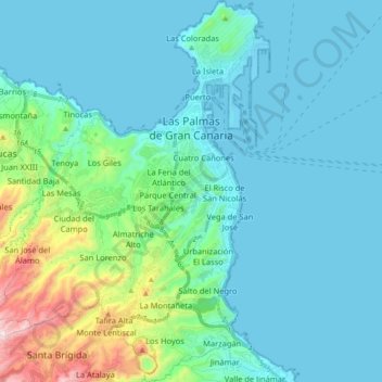
Name: Las Palmas de Gran Canaria topographic map, elevation, terrain.
Average elevation: 119 m
Minimum elevation: -7 m
Maximum elevation: 774 m
Other topographic maps
Click on a map to view its topography, its elevation and its terrain.