
Rajszew topographic map
Interactive map
Click on the map to display elevation.
About this map
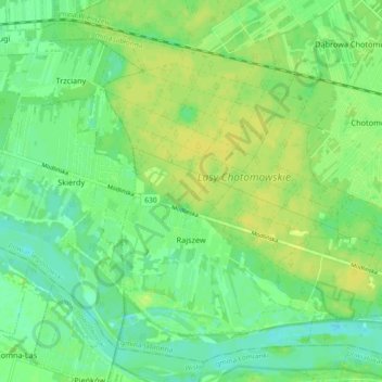
Name: Rajszew topographic map, elevation, terrain.
Average elevation: 79 m
Minimum elevation: 69 m
Maximum elevation: 87 m
Other topographic maps
Click on a map to view its topography, its elevation and its terrain.
Serock
Poland > Masovian Voivodeship > Legionowo County > Serock > Serock
Serock, gmina Serock, Legionowo County, Masovian Voivodeship, 05-140, Poland
Average elevation: 92 m
Wieliszew
Poland > Masovian Voivodeship > Legionowo County
Wieliszew, gmina Wieliszew, Legionowo County, Masovian Voivodeship, 05-135, Poland
Average elevation: 82 m
Serock
Poland > Masovian Voivodeship > Legionowo County
Serock, gmina Serock, Legionowo County, Masovian Voivodeship, 05-140, Poland
Average elevation: 94 m