
Iraq (Baghdad) topographic map
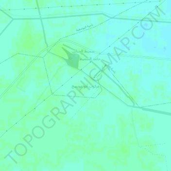
Interactive map
Click on the map to display elevation.
About this map
Name: Iraq (Baghdad) topographic map, elevation, terrain.
Average elevation: 36 m
Minimum elevation: 33 m
Maximum elevation: 39 m
Other topographic maps
Click on a map to view its topography, its elevation and its terrain.
Baghdad
Baghdad, Green Zone Municipality, Baghdad Governorate, Iraq
Average elevation: 36 m
First Al-Sadr District
Iraq > Baghdad Governorate > Baghdad
First Al-Sadr District, Baghdad, Zawra District, Baghdad Governorate, 74125, Iraq
Average elevation: 38 m
Nile
Iraq > Baghdad Governorate > Baghdad
Nile, Palestine Subdistrict, Al-Rusafa District, Baghdad, Al-Rusafa Municipality, Baghdad Governorate, 10045, Iraq
Average elevation: 37 m
Al-Rusafa District
Iraq > Baghdad Governorate > Baghdad
Al-Rusafa District, Baghdad, Al-Ghadir Municipality, Baghdad Governorate, Iraq
Average elevation: 37 m
Al-Adhamiyah District
Iraq > Baghdad Governorate > Baghdad
Al-Adhamiyah District, Baghdad, Al-Sha'ab Municipality, Baghdad Governorate, Iraq
Average elevation: 38 m
Al Rasheed Camp
Iraq > Baghdad Governorate > Baghdad
Al Rasheed Camp, Zaefarania Subdistrict, Al-Rusafa District, Baghdad, Baghdad Governorate, Iraq
Average elevation: 36 m
Al Madain
Al Madain, Al-Mada'in Central Subdistrict, Al-Mada'in District, Baghdad Governorate, Iraq
Average elevation: 33 m
District 103
Iraq > Baghdad Governorate > Baghdad
District 103, Al Saadoom Park, Al-Rusafa Municipality, Baghdad, Al-Rusafa Central Subdistrict, Al-Rusafa District, Baghdad Governorate, Iraq
Average elevation: 38 m
Al-Karrada Municipality
Iraq > Baghdad Governorate > Baghdad
Al-Karrada Municipality, Baghdad, Al-Karrada Subdistrict, Al-Rusafa District, Baghdad Governorate, Iraq
Average elevation: 36 m
Al Idrisi
Iraq > Baghdad Governorate > Baghdad > Al Idrisi
Al Idrisi, Idrissi, Al-Rusafa Municipality, Baghdad, Mustansiriyah Subdistrict, Al-Rusafa District, Baghdad Governorate, 511, Iraq
Average elevation: 37 m
المنصور
Iraq > Baghdad Governorate > Baghdad > المنصور
المنصور, Baghdad, Al-Mansour Subdistrict, Al-Karkh District, Baghdad Governorate, 609, Iraq
Average elevation: 38 m
Abu Ghraib
Iraq > Baghdad Governorate > Abu Ghraib
Abu Ghraib, Abu Ghraib Central Subdistrict, Abu Ghraib District, Baghdad Governorate, Iraq
Average elevation: 37 m
Hayy al Kindi
Iraq > Baghdad Governorate > Baghdad > Hayy al Kindi
Hayy al Kindi, Al-Kindi, Al-Karkh Municipality, Baghdad, Al-Karkh Central Subdistrict, Al-Karkh District, Baghdad Governorate, 222, Iraq
Average elevation: 38 m
Al-Rusafa Municipality
Iraq > Baghdad Governorate > Baghdad
Al-Rusafa Municipality, Baghdad, Al-Rusafa Central Subdistrict, Al-Rusafa District, Baghdad Governorate, Iraq
Average elevation: 38 m
Al-Kadhimiya Municipality
Iraq > Baghdad Governorate > Baghdad
Al-Kadhimiya Municipality, Baghdad, Al-Kadhimiya Central Subdistrict, Al-Kadhimiya District, Baghdad Governorate, Iraq
Average elevation: 37 m
At Taji
At Taji, Al-Taji Subdistrict, Al-Kadhimiya District, Baghdad Governorate, Iraq
Average elevation: 38 m
Al-Karkh Municipality
Iraq > Baghdad Governorate > Baghdad
Al-Karkh Municipality, Baghdad, Al-Karkh Central Subdistrict, Al-Karkh District, Baghdad Governorate, Iraq
Average elevation: 38 m
Al-Adhamiyah Municipality
Iraq > Baghdad Governorate > Baghdad City
Al-Adhamiyah Municipality, Maghreb, Al-Adhamiyah Central Subdistrict, Al-Adhamiyah District, Baghdad City, Baghdad Governorate, Iraq
Average elevation: 38 m
Al-Mansour Municipality
Iraq > Baghdad Governorate > Baghdad
Al-Mansour Municipality, Baghdad, Al-Mansour Subdistrict, Al-Karkh District, Baghdad Governorate, Iraq
Average elevation: 36 m
Hayy al Adl
Iraq > Baghdad Governorate > Baghdad > Hayy al Adl
Hayy al Adl, Al-Adil, Al-Mansour Municipality, Baghdad, Al-Mansour Subdistrict, Al-Karkh District, Baghdad Governorate, 10035, Iraq
Average elevation: 37 m
An Nil
Iraq > Baghdad Governorate > Baghdad > An Nil
An Nil, Nile, Al-Rusafa Municipality, Baghdad, Mustansiriyah Subdistrict, Al-Rusafa District, Baghdad Governorate, 10045, Iraq
Average elevation: 37 m
Al-Ghadir Municipality
Iraq > Baghdad Governorate > Baghdad
Al-Ghadir Municipality, Baghdad, 7 Nissan Subdistrict, Al-Rusafa District, Baghdad Governorate, Iraq
Average elevation: 37 m
الكاظمية
Iraq > Baghdad Governorate > Baghdad > الكاظمية
الكاظمية, Baghdad, Al-Kadhimiya Central Subdistrict, Al-Kadhimiya District, Baghdad Governorate, 100009, Iraq
Average elevation: 38 m
Ar Rashidiyah
Iraq > Baghdad Governorate > Ar Rashidiyah
Ar Rashidiyah, Ar-Rashidiyah Subdistrict, Al-Istiqlal District, Baghdad Governorate, Iraq
Average elevation: 38 m
Sadr City
Iraq > Baghdad Governorate > Second Al-Sadr Municipality > Sadr City
Sadr City, Second Al-Sadr Municipality, Al-Nura Subdsitrict, Second Al-Sadr District, Baghdad Governorate, 10057, Iraq
Average elevation: 38 m
Al Wahdah
Iraq > Baghdad Governorate > Al Wahdah
Al Wahdah, Al-Wahda Subdistrict, Al-Mada'in District, Baghdad Governorate, +9647, Iraq
Average elevation: 31 m
Al-Rashid Municipality
Iraq > Baghdad Governorate > Baghdad
Al-Rashid Municipality, Baghdad, Al-Ma'mun Subdistrict, Al-Karkh District, Baghdad Governorate, Iraq
Average elevation: 35 m