
Rumbeke topographic map
Interactive map
Click on the map to display elevation.
About this map
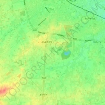
Name: Rumbeke topographic map, elevation, terrain.
Location: Rumbeke, Roulers, Flandre-Occidentale, Belgique (50.88701 3.09753 50.94323 3.17849)
Average elevation: 23 m
Minimum elevation: 4 m
Maximum elevation: 38 m
Other topographic maps
Click on a map to view its topography, its elevation and its terrain.
Beitem
Belgique > Flandre-Occidentale > Roulers > Roulers
Beitem, Roulers, Flandre-Occidentale, Flandre, 8890, Belgique
Average elevation: 26 m