
Thank you for supporting this site ❤️
Make a donation
Make a donation
Perry topographic map
Click on the map to display elevation.
Thank you for supporting this site ❤️
Make a donation
Make a donation
About this map
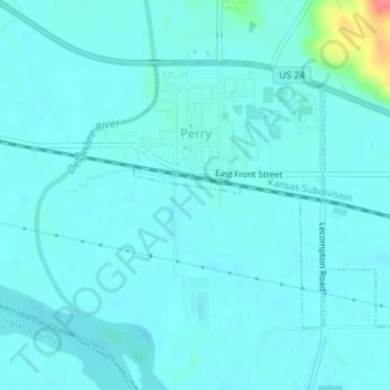
Name: Perry topographic map, elevation, terrain.
Location: Perry, Jefferson County, Kansas, United States (39.06232 -95.40362 39.08069 -95.37272)
Average elevation: 261 m
Minimum elevation: 252 m
Maximum elevation: 323 m
Thank you for supporting this site ❤️
Make a donation
Make a donation
Other topographic maps
Click on a map to view its topography, its elevation and its terrain.
Valley Falls
United States > Kansas > Jefferson County > Valley Falls > Valley Falls
Average elevation: 296 m