
Río Huallaga topographic map
Interactive map
Click on the map to display elevation.
About this map
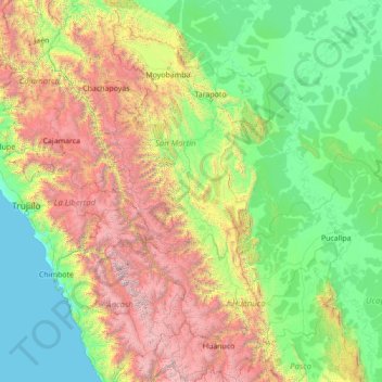
Name: Río Huallaga topographic map, elevation, terrain.
Location: Río Huallaga, Mariscal Cáceres, San Martín, 10003, Perú (-10.52979 -76.79377 -5.05629 -75.55541)
Average elevation: 1,253 m
Minimum elevation: 0 m
Maximum elevation: 6,597 m
Other topographic maps
Click on a map to view its topography, its elevation and its terrain.
Provincia de Tocache
Provincia de Tocache, San Martín, Perú
Average elevation: 1,845 m
Provincia de Tocache
Perú > San Martín > Pólvora
Provincia de Tocache, Pólvora, Tocache, San Martín, Perú
Average elevation: 1,539 m