
Craiova topographic map
Interactive map
Click on the map to display elevation.
About this map
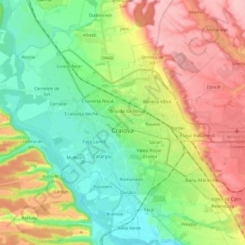
Name: Craiova topographic map, elevation, terrain.
Location: Craiova, Dolj, Roumanie (44.26812 23.70792 44.37865 23.90582)
Average elevation: 127 m
Minimum elevation: 66 m
Maximum elevation: 216 m