
Le Tilleul topographic map
Interactive map
Click on the map to display elevation.
About this map
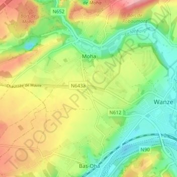
Name: Le Tilleul topographic map, elevation, terrain.
Location: Le Tilleul, Wanze, Huy, Liège, Wallonie, 4520, Belgique (50.51984 5.16772 50.55984 5.20772)
Average elevation: 119 m
Minimum elevation: 64 m
Maximum elevation: 191 m