
Thank you for supporting this site ❤️
Make a donation
Make a donation
Sulima topographic map
Click on the map to display elevation.
Thank you for supporting this site ❤️
Make a donation
Make a donation
About this map
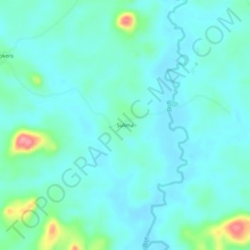
Name: Sulima topographic map, elevation, terrain.
Location: Sulima, Kono District, Eastern Province, Sierra Leone (8.87797 -10.91026 8.91797 -10.87026)
Average elevation: 410 m
Minimum elevation: 391 m
Maximum elevation: 499 m
Thank you for supporting this site ❤️
Make a donation
Make a donation