
Quadrazais topographic map
Interactive map
Click on the map to display elevation.
About this map
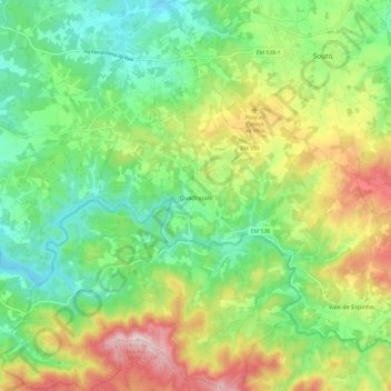
Name: Quadrazais topographic map, elevation, terrain.
Location: Quadrazais, Sabugal, Guarda, Portugal (40.27821 -7.04428 40.37028 -6.94953)
Average elevation: 882 m
Minimum elevation: 768 m
Maximum elevation: 1,076 m
Other topographic maps
Click on a map to view its topography, its elevation and its terrain.
Ozendo
Portugal > Guarda > Quadrazais
Ozendo, Quadrazais, Sabugal, Guarda, 6320-241, Portugal
Average elevation: 855 m