
Laguna de Guájaro topographic map
Interactive map
Click on the map to display elevation.
About this map
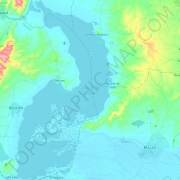
Name: Laguna de Guájaro topographic map, elevation, terrain.
Location: Laguna de Guájaro, Repelón, Atlántico, Colombia (10.40727 -75.12372 10.62532 -75.00425)
Average elevation: 44 m
Minimum elevation: 0 m
Maximum elevation: 346 m
Other topographic maps
Click on a map to view its topography, its elevation and its terrain.
Cien Pesos
Colombia > Atlántico > Repelón
Cien Pesos, Repelón, Atlántico, RAP Caribe, Colombia
Average elevation: 219 m