
Hhohho Region topographic map
Interactive map
Click on the map to display elevation.
About this map
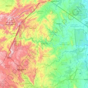
Name: Hhohho Region topographic map, elevation, terrain.
Location: Hhohho Region, Eswatini (-26.48307 30.89993 -25.71876 31.75978)
Average elevation: 748 m
Minimum elevation: 225 m
Maximum elevation: 1,882 m
Other topographic maps
Click on a map to view its topography, its elevation and its terrain.