
Thank you for supporting this site ❤️
Make a donation
Make a donation
Lolegaon topographic map
Click on the map to display elevation.
Thank you for supporting this site ❤️
Make a donation
Make a donation
About this map
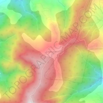
Name: Lolegaon topographic map, elevation, terrain.
Location: Lolegaon, Kalimpong -I, Kalimpong, West Bengal, India (27.00041 88.54502 27.04041 88.58502)
Average elevation: 1,335 m
Minimum elevation: 747 m
Maximum elevation: 1,829 m
Thank you for supporting this site ❤️
Make a donation
Make a donation