
Thank you for supporting this site ❤️
Make a donation
Make a donation
Saint-Maurice topographic map
Click on the map to display elevation.
Thank you for supporting this site ❤️
Make a donation
Make a donation
About this map
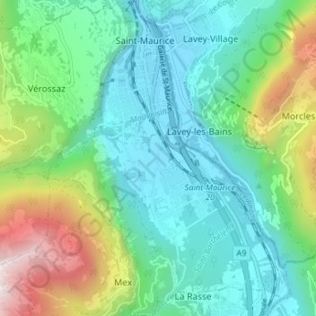
Name: Saint-Maurice topographic map, elevation, terrain.
Location: Saint-Maurice, Valais, 1890, Suisse (46.18025 6.99400 46.22553 7.03468)
Average elevation: 805 m
Minimum elevation: 406 m
Maximum elevation: 1,930 m
Thank you for supporting this site ❤️
Make a donation
Make a donation
Other topographic maps
Click on a map to view its topography, its elevation and its terrain.