
Thank you for supporting this site ❤️
Make a donation
Make a donation
Dhar Kalan topographic map
Click on the map to display elevation.
Thank you for supporting this site ❤️
Make a donation
Make a donation
About this map
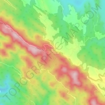
Name: Dhar Kalan topographic map, elevation, terrain.
Location: Dhar Kalan, Dhar Kalan Tahsil, Pathankot, Punjab, India (32.39176 75.77228 32.43176 75.81228)
Average elevation: 599 m
Minimum elevation: 459 m
Maximum elevation: 752 m
Thank you for supporting this site ❤️
Make a donation
Make a donation
Other topographic maps
Click on a map to view its topography, its elevation and its terrain.