
Thank you for supporting this site ❤️
Make a donation
Make a donation
Kastel topographic map
Click on the map to display elevation.
Thank you for supporting this site ❤️
Make a donation
Make a donation
About this map
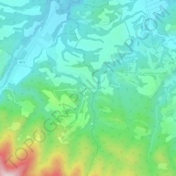
Name: Kastel topographic map, elevation, terrain.
Location: Kastel, Batoshevo, Sevlievo, Gabrovo, 5333, Bulgaria (42.88370 25.09438 42.92370 25.13438)
Average elevation: 355 m
Minimum elevation: 235 m
Maximum elevation: 729 m
Thank you for supporting this site ❤️
Make a donation
Make a donation
Other topographic maps
Click on a map to view its topography, its elevation and its terrain.
Thank you for supporting this site ❤️
Make a donation
Make a donation