
Thank you for supporting this site ❤️
Make a donation
Make a donation
Bouyssou topographic map
Click on the map to display elevation.
Thank you for supporting this site ❤️
Make a donation
Make a donation
About this map
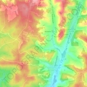
Name: Bouyssou topographic map, elevation, terrain.
Average elevation: 135 m
Minimum elevation: 75 m
Maximum elevation: 185 m
Thank you for supporting this site ❤️
Make a donation
Make a donation
Other topographic maps
Click on a map to view its topography, its elevation and its terrain.
Étangs de l'Hôpital
France > Nouvelle-Aquitaine > Dordogne > Chantérac > Charrièras
Average elevation: 188 m