
Thank you for supporting this site ❤️
Make a donation
Make a donation
Birkeland topographic map
Click on the map to display elevation.
Thank you for supporting this site ❤️
Make a donation
Make a donation
About this map
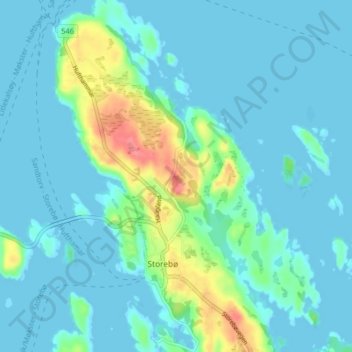
Name: Birkeland topographic map, elevation, terrain.
Location: Birkeland, Storebø, Austevoll, Vestland, 5392, Norge (60.08605 5.20779 60.12605 5.24779)
Average elevation: 12 m
Minimum elevation: -2 m
Maximum elevation: 66 m
Thank you for supporting this site ❤️
Make a donation
Make a donation
Other topographic maps
Click on a map to view its topography, its elevation and its terrain.