
Thank you for supporting this site ❤️
Make a donation
Make a donation
Addison topographic map
Click on the map to display elevation.
Thank you for supporting this site ❤️
Make a donation
Make a donation
About this map
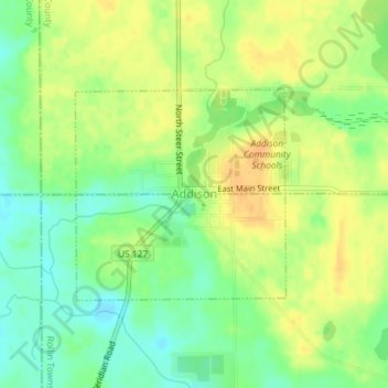
Name: Addison topographic map, elevation, terrain.
Location: Addison, Lenawee County, Michigan, United States (41.97886 -84.35912 41.99356 -84.33940)
Average elevation: 320 m
Minimum elevation: 304 m
Maximum elevation: 334 m
Thank you for supporting this site ❤️
Make a donation
Make a donation
Other topographic maps
Click on a map to view its topography, its elevation and its terrain.