
Thank you for supporting this site ❤️
Make a donation
Make a donation
Skorarnar topographic map
Click on the map to display elevation.
Thank you for supporting this site ❤️
Make a donation
Make a donation
About this map
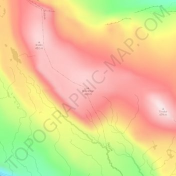
Name: Skorarnar topographic map, elevation, terrain.
Location: Skorarnar, Skálavík, Sandoyar sýsla, 220, Færøerne (61.84953 -6.76878 61.84963 -6.76868)
Average elevation: 299 m
Minimum elevation: 16 m
Maximum elevation: 466 m
Thank you for supporting this site ❤️
Make a donation
Make a donation