
Thank you for supporting this site ❤️
Make a donation
Make a donation
Perl topographic map
Click on the map to display elevation.
Thank you for supporting this site ❤️
Make a donation
Make a donation
About this map
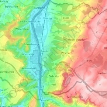
Name: Perl topographic map, elevation, terrain.
Location: Perl, Landkreis Merzig-Wadern, Saarland, 66706, Germany (49.45285 6.35760 49.55137 6.50062)
Average elevation: 263 m
Minimum elevation: 137 m
Maximum elevation: 430 m
Thank you for supporting this site ❤️
Make a donation
Make a donation
Other topographic maps
Click on a map to view its topography, its elevation and its terrain.