
Thank you for supporting this site ❤️
Make a donation
Make a donation
Katzwinkel (Sieg) topographic map
Click on the map to display elevation.
Thank you for supporting this site ❤️
Make a donation
Make a donation
Katzwinkel (Sieg)
Die Topographisch-Statistische Beschreibung der Königlich Preußischen Rheinprovinzen von 1830 beschreibt die Gemeinde Nochen (heute Katzwinkel) wie folgt.
Thank you for supporting this site ❤️
Make a donation
Make a donation
About this map
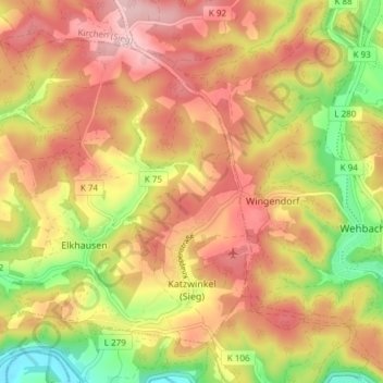
Name: Katzwinkel (Sieg) topographic map, elevation, terrain.
Average elevation: 282 m
Minimum elevation: 157 m
Maximum elevation: 379 m
Thank you for supporting this site ❤️
Make a donation
Make a donation
Other topographic maps
Click on a map to view its topography, its elevation and its terrain.
Niederbach
Deutschland > Rheinland-Pfalz > Landkreis Altenkirchen (Westerwald) > Steckelbach
Average elevation: 255 m