
Thank you for supporting this site ❤️
Make a donation
Make a donation
Schaveren topographic map
Click on the map to display elevation.
Thank you for supporting this site ❤️
Make a donation
Make a donation
About this map
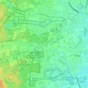
Name: Schaveren topographic map, elevation, terrain.
Location: Schaveren, Emst, Epe, Gelderland, Nederland, 8166 HD, Nederland (52.30353 5.93101 52.34353 5.97101)
Average elevation: 18 m
Minimum elevation: 8 m
Maximum elevation: 36 m
Thank you for supporting this site ❤️
Make a donation
Make a donation