
Thank you for supporting this site ❤️
Make a donation
Make a donation
Sylt topographic map
Click on the map to display elevation.
Thank you for supporting this site ❤️
Make a donation
Make a donation
About this map
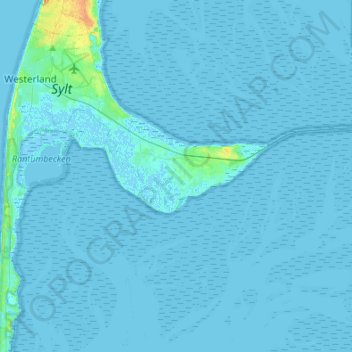
Name: Sylt topographic map, elevation, terrain.
Location: Sylt, Nordfriesland, Schleswig-Holstein, 25980, Deutschland (54.79571 8.28045 54.93115 8.55104)
Average elevation: 1 m
Minimum elevation: -4 m
Maximum elevation: 27 m
Thank you for supporting this site ❤️
Make a donation
Make a donation