
Thank you for supporting this site ❤️
Make a donation
Make a donation
Hornsborg topographic map
Click on the map to display elevation.
Thank you for supporting this site ❤️
Make a donation
Make a donation
About this map
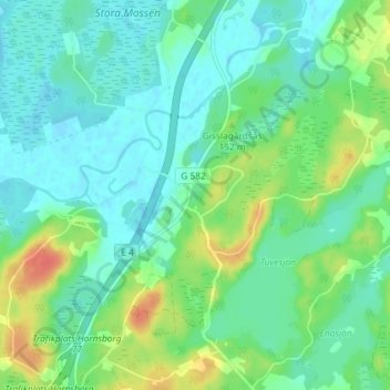
Name: Hornsborg topographic map, elevation, terrain.
Location: Hornsborg, Ljungby kommun, Kronobergs län, Zweden (56.62107 13.78799 56.66107 13.82799)
Average elevation: 137 m
Minimum elevation: 124 m
Maximum elevation: 169 m
Thank you for supporting this site ❤️
Make a donation
Make a donation
Other topographic maps
Click on a map to view its topography, its elevation and its terrain.