
Thank you for supporting this site ❤️
Make a donation
Make a donation
Carvalhal da Azoia topographic map
Click on the map to display elevation.
Thank you for supporting this site ❤️
Make a donation
Make a donation
About this map
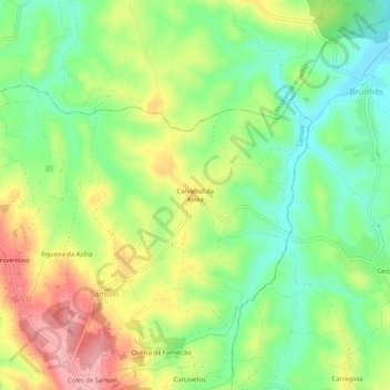
Name: Carvalhal da Azoia topographic map, elevation, terrain.
Location: Carvalhal da Azoia, Samuel, Soure, Coimbra, Portugal (40.08553 -8.71293 40.12553 -8.67293)
Average elevation: 61 m
Minimum elevation: 3 m
Maximum elevation: 139 m
Thank you for supporting this site ❤️
Make a donation
Make a donation