
Thank you for supporting this site ❤️
Make a donation
Make a donation
Jomoro topographic map
Click on the map to display elevation.
Thank you for supporting this site ❤️
Make a donation
Make a donation
About this map
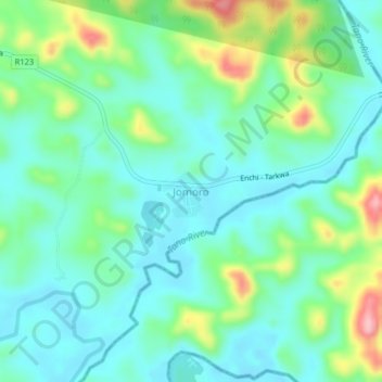
Name: Jomoro topographic map, elevation, terrain.
Location: Jomoro, Aowin Municipal District, Western North Region, Ghana (5.73970 -2.61121 5.77970 -2.57121)
Average elevation: 87 m
Minimum elevation: 47 m
Maximum elevation: 201 m
Thank you for supporting this site ❤️
Make a donation
Make a donation
Other topographic maps
Click on a map to view its topography, its elevation and its terrain.