
Thank you for supporting this site ❤️
Make a donation
Make a donation
Wicheried topographic map
Click on the map to display elevation.
Thank you for supporting this site ❤️
Make a donation
Make a donation
About this map
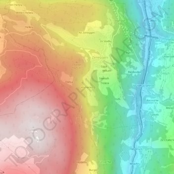
Name: Wicheried topographic map, elevation, terrain.
Location: Wicheried, Zeneggen, Visp, Wallis, 3934, Schweiz (46.24629 7.84136 46.28629 7.88136)
Average elevation: 1,377 m
Minimum elevation: 648 m
Maximum elevation: 2,114 m
Thank you for supporting this site ❤️
Make a donation
Make a donation