
Thank you for supporting this site ❤️
Make a donation
Make a donation
Retreat topographic map
Click on the map to display elevation.
Thank you for supporting this site ❤️
Make a donation
Make a donation
About this map
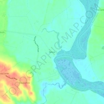
Name: Retreat topographic map, elevation, terrain.
Location: Retreat, Hanover County, Virginia, United States (37.61838 -77.15076 37.65838 -77.11076)
Average elevation: 13 m
Minimum elevation: -1 m
Maximum elevation: 49 m
Thank you for supporting this site ❤️
Make a donation
Make a donation
Other topographic maps
Click on a map to view its topography, its elevation and its terrain.