
Thank you for supporting this site ❤️
Make a donation
Make a donation
Serra do Arestal topographic map
Click on the map to display elevation.
Thank you for supporting this site ❤️
Make a donation
Make a donation
About this map
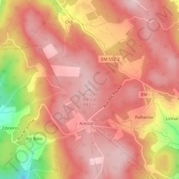
Name: Serra do Arestal topographic map, elevation, terrain.
Location: Serra do Arestal, Vale de Cambra, Aveiro, 3730-001, Portugal (40.79324 -8.35781 40.79334 -8.35771)
Average elevation: 769 m
Minimum elevation: 594 m
Maximum elevation: 838 m
Thank you for supporting this site ❤️
Make a donation
Make a donation
Other topographic maps
Click on a map to view its topography, its elevation and its terrain.