
Thank you for supporting this site ❤️
Make a donation
Make a donation
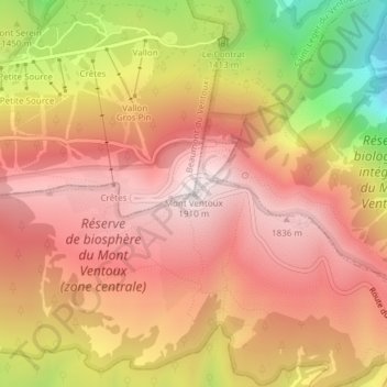
Mont Ventoux topographic map
Click on the map to display elevation.
Thank you for supporting this site ❤️
Make a donation
Make a donation
Mont Ventoux
There are two small ski stations on the mountain: "Mont Serein" on the north side, and "Chalet Reynard" on the south. High winds and the modest elevation tend to limit the ski season. Weather conditions are such that the northern slope is often icy, leading to a saying among people of the surrounding region regarding the challenges of skiing the mountain: Qui skie au Ventoux, skie partout (If you can ski Ventoux, you can ski anywhere).
Thank you for supporting this site ❤️
Make a donation
Make a donation
About this map
Name: Mont Ventoux topographic map, elevation, terrain.
Average elevation: 1,557 m
Minimum elevation: 945 m
Maximum elevation: 1,905 m
Thank you for supporting this site ❤️
Make a donation
Make a donation