
Luganville topographic map
Interactive map
Click on the map to display elevation.
About this map
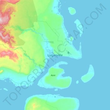
Name: Luganville topographic map, elevation, terrain.
Location: Luganville, Sanma, Vanuatu (-15.67211 167.01844 -15.35211 167.33844)
Average elevation: 73 m
Minimum elevation: 0 m
Maximum elevation: 595 m