
Rothleiten topographic map
Interactive map
Click on the map to display elevation.
About this map
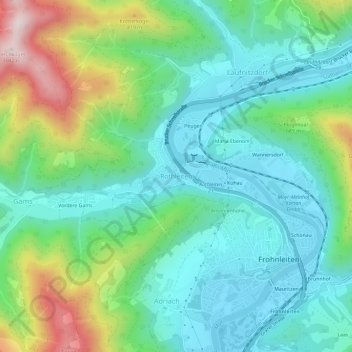
Name: Rothleiten topographic map, elevation, terrain.
Average elevation: 585 m
Minimum elevation: 416 m
Maximum elevation: 1,031 m
Other topographic maps
Click on a map to view its topography, its elevation and its terrain.
Vordere Gams
Österreich > Steiermark > Bezirk Graz-Umgebung > Frohnleiten > Rothleiten
Vordere Gams, Rothleiten, Frohnleiten, Bezirk Graz-Umgebung, Steiermark, 8130, Österreich
Average elevation: 631 m