
Halltal topographic map
Interactive map
Click on the map to display elevation.
About this map
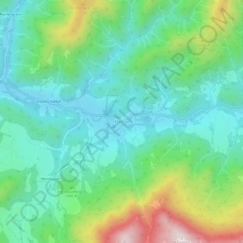
Name: Halltal topographic map, elevation, terrain.
Average elevation: 983 m
Minimum elevation: 783 m
Maximum elevation: 1,502 m
Other topographic maps
Click on a map to view its topography, its elevation and its terrain.
Sankt Sebastian
Österreich > Steiermark > Bezirk Bruck-Mürzzuschlag > Mariazell
Sankt Sebastian, Mariazell, Bezirk Bruck-Mürzzuschlag, Steiermark, 8630, Österreich
Average elevation: 926 m