
Thank you for supporting this site ❤️
Make a donation
Make a donation
La Cienega topographic map
Click on the map to display elevation.
Thank you for supporting this site ❤️
Make a donation
Make a donation
About this map
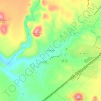
Name: La Cienega topographic map, elevation, terrain.
Location: La Cienega, Santa Fe County, New Mexico, United States (35.54281 -106.15086 35.58281 -106.11086)
Average elevation: 1,850 m
Minimum elevation: 1,774 m
Maximum elevation: 1,952 m
Thank you for supporting this site ❤️
Make a donation
Make a donation
Other topographic maps
Click on a map to view its topography, its elevation and its terrain.