
Vila Franca de Xira topographic map
Interactive map
Click on the map to display elevation.
About this map
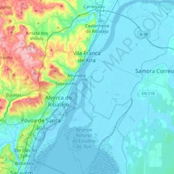
Name: Vila Franca de Xira topographic map, elevation, terrain.
Location: Vila Franca de Xira, Lisbon, Portugal (38.79325 -9.11843 39.03157 -8.84154)
Average elevation: 59 m
Minimum elevation: -3 m
Maximum elevation: 386 m
Other topographic maps
Click on a map to view its topography, its elevation and its terrain.