
Thank you for supporting this site ❤️
Make a donation
Make a donation
Maningning topographic map
Click on the map to display elevation.
Thank you for supporting this site ❤️
Make a donation
Make a donation
About this map
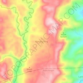
Name: Maningning topographic map, elevation, terrain.
Location: Maningning, Southern Leyte, Eastern Visayas, Philippines (10.14248 124.93590 10.18248 124.97590)
Average elevation: 239 m
Minimum elevation: 34 m
Maximum elevation: 376 m
Thank you for supporting this site ❤️
Make a donation
Make a donation
Other topographic maps
Click on a map to view its topography, its elevation and its terrain.