
Thank you for supporting this site ❤️
Make a donation
Make a donation
Tyre Knob topographic map
Click on the map to display elevation.
Thank you for supporting this site ❤️
Make a donation
Make a donation
About this map
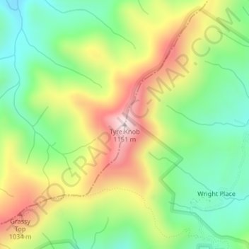
Name: Tyre Knob topographic map, elevation, terrain.
Location: Tyre Knob, Graham County, North Carolina, United States (35.35282 -83.61577 35.35292 -83.61567)
Average elevation: 826 m
Minimum elevation: 619 m
Maximum elevation: 1,114 m
Thank you for supporting this site ❤️
Make a donation
Make a donation
Other topographic maps
Click on a map to view its topography, its elevation and its terrain.