
Thank you for supporting this site ❤️
Make a donation
Make a donation
Plai Phraya topographic map
Click on the map to display elevation.
Thank you for supporting this site ❤️
Make a donation
Make a donation
About this map
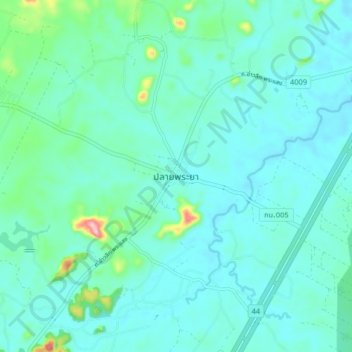
Name: Plai Phraya topographic map, elevation, terrain.
Location: Plai Phraya, Krabi Province, Thailand (8.49118 98.82494 8.57118 98.90494)
Average elevation: 68 m
Minimum elevation: 37 m
Maximum elevation: 247 m
Thank you for supporting this site ❤️
Make a donation
Make a donation