
Thank you for supporting this site ❤️
Make a donation
Make a donation
Donwat topographic map
Click on the map to display elevation.
Thank you for supporting this site ❤️
Make a donation
Make a donation
About this map
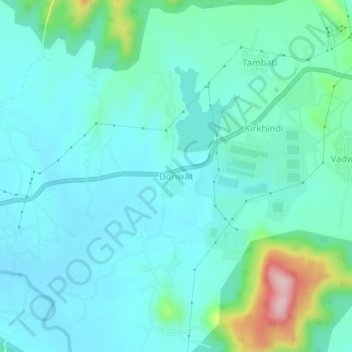
Name: Donwat topographic map, elevation, terrain.
Location: Donwat, Khalapur Taluka, Raigad, Maharashtra, India (18.75861 73.23259 18.79861 73.27259)
Average elevation: 105 m
Minimum elevation: 62 m
Maximum elevation: 296 m
Thank you for supporting this site ❤️
Make a donation
Make a donation
Other topographic maps
Click on a map to view its topography, its elevation and its terrain.