
Thank you for supporting this site ❤️
Make a donation
Make a donation
Lam Sin topographic map
Click on the map to display elevation.
Thank you for supporting this site ❤️
Make a donation
Make a donation
About this map
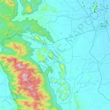
Name: Lam Sin topographic map, elevation, terrain.
Location: Lam Sin, Srinagarindra, Phatthalung Province, Thailand (7.37393 99.77785 7.69393 100.09785)
Average elevation: 172 m
Minimum elevation: 1 m
Maximum elevation: 1,306 m
Thank you for supporting this site ❤️
Make a donation
Make a donation