
Thank you for supporting this site ❤️
Make a donation
Make a donation
Nadupuni topographic map
Click on the map to display elevation.
Thank you for supporting this site ❤️
Make a donation
Make a donation
About this map
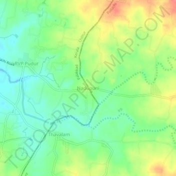
Name: Nadupuni topographic map, elevation, terrain.
Location: Nadupuni, Chittur, Palakkad, Kerala, India (10.70518 76.87045 10.74518 76.91045)
Average elevation: 184 m
Minimum elevation: 158 m
Maximum elevation: 221 m
Thank you for supporting this site ❤️
Make a donation
Make a donation
Other topographic maps
Click on a map to view its topography, its elevation and its terrain.