
Thank you for supporting this site ❤️
Make a donation
Make a donation
Folsom topographic map
Click on the map to display elevation.
Thank you for supporting this site ❤️
Make a donation
Make a donation
About this map
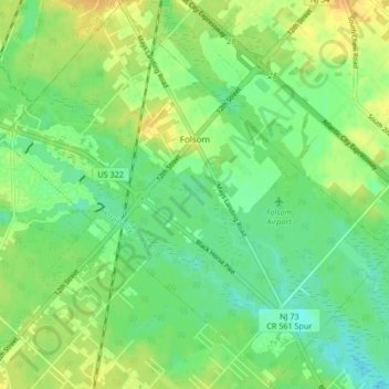
Name: Folsom topographic map, elevation, terrain.
Location: Folsom, Atlantic County, New Jersey, United States (39.56166 -74.88436 39.62409 -74.80078)
Average elevation: 23 m
Minimum elevation: 10 m
Maximum elevation: 38 m
Thank you for supporting this site ❤️
Make a donation
Make a donation
Other topographic maps
Click on a map to view its topography, its elevation and its terrain.
Absecon Highlands
United States > New Jersey > Atlantic County > Galloway Township
Average elevation: 8 m
Thank you for supporting this site ❤️
Make a donation
Make a donation
Brigantine
United States > New Jersey > Atlantic County > Brigantine > Brigantine
Average elevation: 0 m
Egg Harbor Township
United States > New Jersey > Atlantic County > Egg Harbor Township
Average elevation: 13 m
Thank you for supporting this site ❤️
Make a donation
Make a donation