
Thank you for supporting this site ❤️
Make a donation
Make a donation
Diamond Peak topographic map
Click on the map to display elevation.
Thank you for supporting this site ❤️
Make a donation
Make a donation
About this map
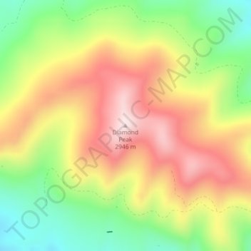
Name: Diamond Peak topographic map, elevation, terrain.
Location: Diamond Peak, Moffat County, Colorado, United States (40.95019 -108.87822 40.95029 -108.87812)
Average elevation: 2,727 m
Minimum elevation: 2,519 m
Maximum elevation: 2,932 m
Thank you for supporting this site ❤️
Make a donation
Make a donation
Other topographic maps
Click on a map to view its topography, its elevation and its terrain.
Dinosaur National Monument
United States > Colorado > Moffat County
Originally preserved in 1915 to protect its famous Dinosaur Quarry, the monument was greatly expanded in 1938 to include its wealth of natural history. The park's wild landscapes, topography, geology, paleontology, and history make it a unique resource for both science and recreation. The park contains over…
Average elevation: 1,988 m
Thank you for supporting this site ❤️
Make a donation
Make a donation