
Thank you for supporting this site ❤️
Make a donation
Make a donation
Kayonza topographic map
Click on the map to display elevation.
Thank you for supporting this site ❤️
Make a donation
Make a donation
About this map
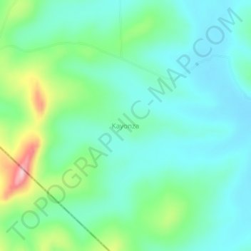
Name: Kayonza topographic map, elevation, terrain.
Location: Kayonza, Kiruhura, Western Region, Uganda (-0.47093 30.75152 -0.43093 30.79152)
Average elevation: 1,365 m
Minimum elevation: 1,316 m
Maximum elevation: 1,512 m
Thank you for supporting this site ❤️
Make a donation
Make a donation
Other topographic maps
Click on a map to view its topography, its elevation and its terrain.