
Thank you for supporting this site ❤️
Make a donation
Make a donation
Dieng Kulon topographic map
Click on the map to display elevation.
Thank you for supporting this site ❤️
Make a donation
Make a donation
About this map
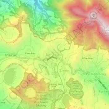
Name: Dieng Kulon topographic map, elevation, terrain.
Location: Dieng Kulon, Banjarnegara, Central Java, Java, Indonesia (-7.22117 109.88836 -7.18117 109.92836)
Average elevation: 2,102 m
Minimum elevation: 1,645 m
Maximum elevation: 2,563 m
Thank you for supporting this site ❤️
Make a donation
Make a donation
Other topographic maps
Click on a map to view its topography, its elevation and its terrain.