
Thank you for supporting this site ❤️
Make a donation
Make a donation
Pak Chong topographic map
Click on the map to display elevation.
Thank you for supporting this site ❤️
Make a donation
Make a donation
About this map
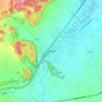
Name: Pak Chong topographic map, elevation, terrain.
Location: Pak Chong, Nakhon Ratchasima Province, Thailand (14.66409 101.37322 14.74409 101.45322)
Average elevation: 349 m
Minimum elevation: 285 m
Maximum elevation: 575 m
Thank you for supporting this site ❤️
Make a donation
Make a donation