
Thank you for supporting this site ❤️
Make a donation
Make a donation
New Tulsa topographic map
Click on the map to display elevation.
Thank you for supporting this site ❤️
Make a donation
Make a donation
About this map
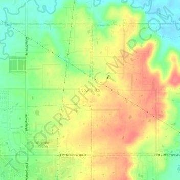
Name: New Tulsa topographic map, elevation, terrain.
Location: New Tulsa, Wagoner County, Oklahoma, United States (36.05510 -95.69276 36.09510 -95.65276)
Average elevation: 203 m
Minimum elevation: 169 m
Maximum elevation: 236 m
Thank you for supporting this site ❤️
Make a donation
Make a donation
Other topographic maps
Click on a map to view its topography, its elevation and its terrain.