
Thank you for supporting this site ❤️
Make a donation
Make a donation
Berg Clouse topographic map
Click on the map to display elevation.
Thank you for supporting this site ❤️
Make a donation
Make a donation
About this map
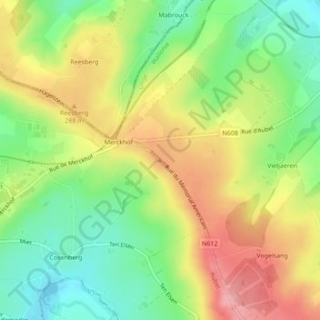
Name: Berg Clouse topographic map, elevation, terrain.
Location: Berg Clouse, Aubel, Verviers, Liège, Wallonie, 4880, Belgique (50.70811 5.88933 50.70821 5.88943)
Average elevation: 257 m
Minimum elevation: 203 m
Maximum elevation: 318 m
Thank you for supporting this site ❤️
Make a donation
Make a donation