
Thank you for supporting this site ❤️
Make a donation
Make a donation
Sonega topographic map
Click on the map to display elevation.
Thank you for supporting this site ❤️
Make a donation
Make a donation
About this map
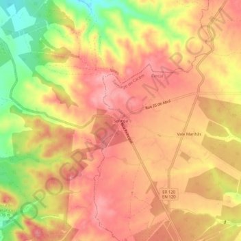
Name: Sonega topographic map, elevation, terrain.
Location: Sonega, Cercal, Santiago do Cacém, Setúbal, 7555-267, Portugal (37.84687 -8.74066 37.88687 -8.70066)
Average elevation: 152 m
Minimum elevation: 74 m
Maximum elevation: 193 m
Thank you for supporting this site ❤️
Make a donation
Make a donation